

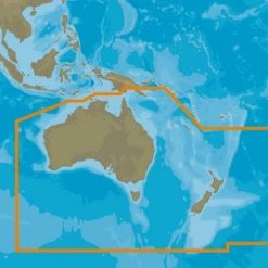
C-MAP MAX-N+ SD/MSD Chart Card New Zealand
Original price was: $189.00.$92.99Current price is: $92.99.
- Shop with confidence, enjoy free returns.
- Secure Shopping with Safe Payments
- Quality at its Finest
- Safe Payments for a Better Shopping Experience
Take your boating experience to the next level
The C-MAP MAX-N+ Chart Card brings trusted
Jeppesen data and advanced charting features to users of compatible
Lowrance, Simrad and B&G navigation systems. Whether you’re an
avid saltwater angler, sailing enthusiast or long-range cruiser,
these powerful charts will enhance every moment you spend on the
water. With huge coverage areas, up-to-date data and
state-of-the-art features, no adventure is out of reach.
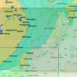
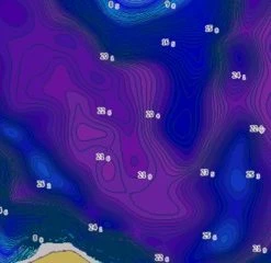
Full-Featured Vector Charts
C-MAP MAX-N+ provides boaters with the accurate, up-to-date vector
chart detail including Depth Areas and Contours, Spot Soundings,
NavAids, Light Sectors, Wrecks/Obstructions, Small Craft Facilities
and more.
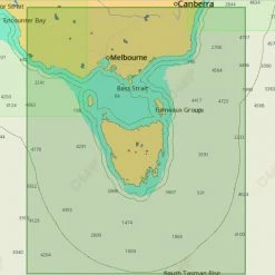
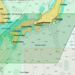
Harbour and Approach Details
The detail and information available with C-MAP MAX-N+ charts lets
boaters approach any harbour and inlet with confidence. The perfect
conclusion to a long voyage, sailing adventure or exciting day of
bluewater fishing.
Tides & Currents
The C-MAP MAX N+ Tides & Currents feature presents the time, water
level and direction of tides with Tide Level graphs and indicates
predicted current time, direction and strength of currents with
Current Flow graphs and coloured arrows. This information is vital
for navigation and fishing.
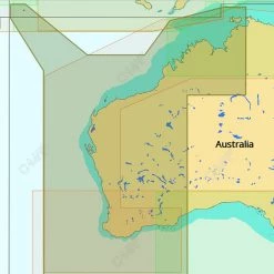
C-Marina Port Database
C-Marina Port database and detailed marina charts in C-MAP MAX-N+
provides useful, categorised information for cruisers, fishermen
and sailors — including Port Layout and Facilities, Operating
Hours, Accessibility, Phone/Email Contact Info and more.
Easy Routing
Automatically plots the shortest, safest route based on detailed
chart data and vessel information. Easy Routing quickly takes two
points and generates a suggested route, while highlighting
potential dangers such as shoals, sandbars, submerged rocks and
other obstacles.
Detailed Marina Port Plans
Docking in an unfamiliar port is no problem, when you have precise
layouts of thousands of marinas, including slip spaces, restricted
areas and other valuable navigation information.
Dynamic Raster
Traditional “paper chart” look with unique ability to access
information on buoys, lights and other details.
Satellite
High-resolution satellite imagery provides real-world reference,
enhances situational awareness for coastal navigation.
Depth Shading
The highest available detail of underwater pinnacles, ledges and
canyons that are magnets for offshore and coastal gamefish.
C-MAP MAX-N+ Chart Card Features:
- Dynamic Raster Charts give sailors a traditional “nautical
chart” view with the ability to access important information.
High-Resolution Bathymetric (HRB) charts and Sportfishing Data
deliver powerful technology for avid anglers - Tides & Currents projections help both sailors and anglers plan
their day - Easy Routing helps to automatically plot the shortest, safest
route based on detailed chart data and user vessel
information. - New depth shading: many options available whether you set a
safety depth, maintain a paper like view or your own custom colour
for depths
C-MAP MAX-N+ Chart Card Specifications:
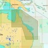
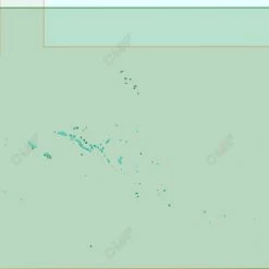
- Available coverage: New Zealand (Wide)
- Format: SD Card
- Compatible units: Lowrance Ti (5,7) and HDS models (Gen 2 -5/5m/7/7m/8/8m/10/10m, 2 Touch -7/7m/9/9m/12/12m, Gen 3 7/9/12)
Be the first to review “C-MAP MAX-N+ SD/MSD Chart Card New Zealand”
Related products

GPS Charts
GPS Charts
GPS Charts

GPS Charts
Reviews
There are no reviews yet.