
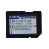

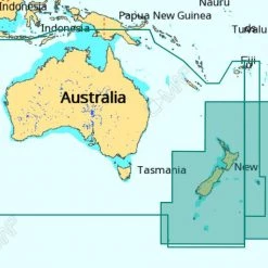
C-MAP MAX-N+ Chart Card New Zealand And Australia Continental MSD Card
Original price was: $369.00.$94.99Current price is: $94.99.
- Shop with confidence, enjoy free returns.
- Secure Shopping with Safe Payments
- Quality at its Finest
- Safe Payments for a Better Shopping Experience
Get onboard for the future!
Made specially for Lowrance, Simrad and B&G chartplotters, the
C-MAP MAX-N+ Chart Card is packed with more
features that open up a new world of performance for cruisers,
sailors and fishos, providing the detail, advanced features and
coverage to fuel every boating and fishing adventure. Access
important information, plan your day and plot your routes, The
C-MAP MAX-N+ is ready to take your boating enjoyment to new
levels.
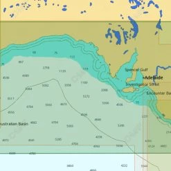
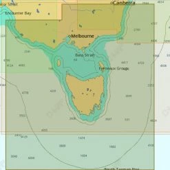
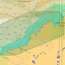
Full-featured vector charts
C-MAP MAX-N provide boaters with the accurate, up-to-date vector
chart detail including Depth Areas and Contours, Spot Soundings,
NavAids, Light Sectors, Wrecks/Obstructions, Small Craft Facilities
and more.
Harbour and approach details
The detail and information available with C-MAP MAX-N charts lets
you approach any harbour and inlet with confidence — the perfect
conclusion to a long voyage, sailing adventure or exciting day of
bluewater fishing.
Tides and currents
The C-MAP MAX N+ Tides & Currents feature presents the time, water
level and direction of tides with Tide Level graphs and indicates
predicted current time, direction and strength of currents with
Current Flow graphs and colored arrows. This information is vital
for navigation and fishing.
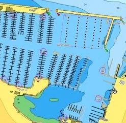
C-Marine port database
C-Marina Port database and detailed marina charts in C-MAP MAX-N+
provides useful, categorized information for cruisers, fishermen
and sailors — including Port Layout and Facilities, Operating
Hours, Accessibility, Phone/Email Contact Info and more.
Easy routing
Automatically plots the shortest, safest route based on detailed
chart data and vessel information. Easy Routing quickly takes two
points and generates a suggested route, while highlighting
potential dangers such as shoals, sandbars, submerged rocks and
other obstacles.
Detailed marine port plans
Docking in an unfamiliar port is no problem, when you have precise
layouts of thousands of marinas, including slip spaces, restricted
areas, and other valuable navigation information.
Dynamic raster
Traditional “paper chart” look with unique ability to access
information on buoys, lights and other details.
Satellite
High-resolution satellite imagery provides real-world reference,
enhances situational awareness for coastal navigation.
Depth shading
The highest available detail of underwater pinnacles, ledges and
canyons that are magnets for offshore and coastal gamefish.
Aerial Photos
High-Definition Photos & Diagrams of ports, marinas and significant
navigational marks.
C-MAP MAX-N+ Chart Card Features:
- Accurate, up-to-date C-MAP chart data
- Exclusive navigation features for Lowrance, Simrad and
B&G - Full-featured vector charts
- Harbour and approach details
- Tides and currents
- Easy routing
- Detailed marine port plans
- Dynamic raster
- Satellite
- Depth shading
- Aerial photos
- Advanced chart detail and feature-rich content
- Large coverage areas meet the needs of many boaters
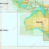
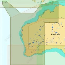
- Coverage: New Zealand and Australia
- Format: Micro SD Card with SD adapter
Be the first to review “C-MAP MAX-N+ Chart Card New Zealand And Australia Continental MSD Card”
Related products
GPS Charts
GPS Charts
GPS Charts

GPS Charts
Reviews
There are no reviews yet.