
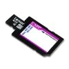

C-MAP 4D MAX SD/MSD Chart Card
Original price was: $369.00.$96.99Current price is: $96.99.
- Shop with confidence, enjoy free returns.
- Secure Shopping with Safe Payments
- Quality at its Finest
- Safe Payments for a Better Shopping Experience
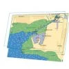
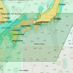
See the real world on your screen
The C-MAP 4D MAX Chart Card is the only maritime
chartplotting solution that lets you completely customize your
digital navigation charts. This card features MAX content and you
can choose when to purchase additional Value-Added-Data to enhance
your boating or sailing experience. With C-MAP 4D MAX, you enjoy
your time on the water knowing your digital marine charts and GPS
maps are based on reliable, updated marine navigation and
information.
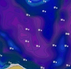
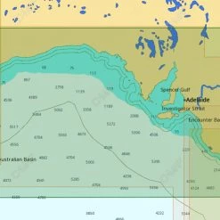
Satellite Images with 2D and 3D Overlay
C-MAP 4D MAX includes a navigational perspective with
high-resolution coastal imagery overlaid on the most accurate and
up-to-date vector data, plus thousands of extraordinary photos for
the most popular marinas and areas of interest.
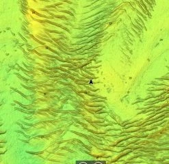
Digital Raster Charts with 2D and 3D Overlay
With raster charts, you have an additional reference source for
navigational awareness. Get “at-a-glance” information using the
nautical paper charts overlaid on the multi-dimensional shaded
relief to have a new visual experience.
Guardian Alarm
When activated, Guardian Alarm performs an automatic
forward-scanning check for obstacles. Use the feature as an added
backup to alert you should you head toward a potentially harmful
object.
Easy Routing
Enter start and end points along with specific boat parameters and
automatically receive waypoints of the shortest route; highlights
potential hazards and displays varying levels of alerts for each
segment of the route, allows you to manually adjust the route.
Value-Added-Data
With C-MAP by Jeppesen charts, you invest in a navigation solution
that continually evolves. In addition to consistent updates, we’re
adding new features and new data that deliver useful information,
taking your charts to a whole new level.
C-MAP 4D MAX Chart Card Features:
- Base Cartogrpahy
- Port Info
- Tidal Heights
- Tidal Flows
- Animated Tidal Arrows
- Ocean Currents
- Guardian Alarm
- Detailed Harbor Charts
- C-Marina Port Database
- Major Roads
- Detailed Roads
- Aerial Photos
- Land Elevations
- Nav-Aids
- Multi-Language (UNICODE)
- Perspective (Bird’s Eye) View
C-MAP 4D MAX Chart Card Specifications:
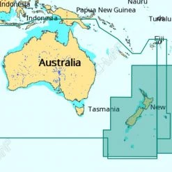
- Available coverage: North Island (Local), South Island (Local),
South Pacific (Wide) - Format: SD/MSD Card
- Furuno 1670,1870, Raymarine MFD (includes bathymetric data
free) (see compatibility chart for more)
C-MAP Compatibility Chart
Be the first to review “C-MAP 4D MAX SD/MSD Chart Card”
Related products
GPS Charts

GPS Charts
GPS Charts

GPS Charts
Reviews
There are no reviews yet.